
Kauai's climate in short
Temperatures hardly change through the year. At the Līhuʻe airport station, the average daily highs run from 25.6 to 29.6 °C (78 to 85 °F), and the average lows from 18.9 to 24.0 °C (66 to 75 °F). What changes is rain. Mountains and windward slopes catch the most, and the lowlands on the lee side stay drier.
That is why the north coast around Hanalei is wetter than the south coast around Poʻipū. The monthly numbers below come from one station near the airport in the southeast, so they describe that spot, not the whole island. Averages are not a forecast for your week.
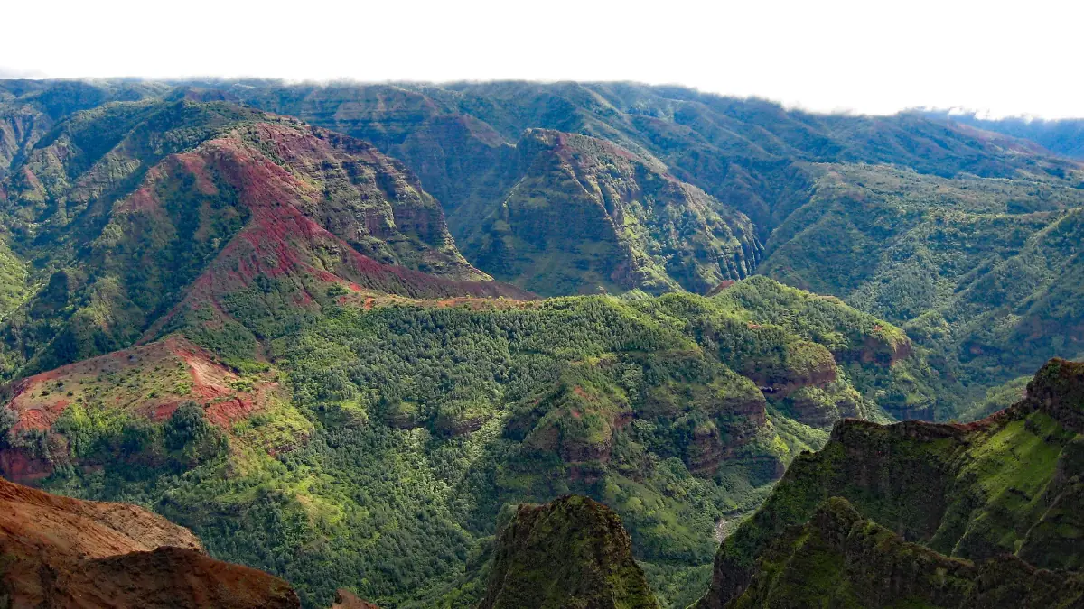
Current status (20 October 2026): September storms left closures in place. Hāʻena State Park reopened on 15 October, while Waimea Canyon, Kōkeʻe and the Kalalau Trail beyond the 2-mile point remain closed. Check the current DLNR notices before you go.
Monthly temperatures and rain at Līhuʻe
NOAA monthly normals for 1991 to 2020, Līhuʻe airport station (about 100 ft / 30 m above sea level), report generated 19 October 2026.
| Month | Average high | Average low | Rain |
|---|---|---|---|
| January | 25.9 °C | 18.9 °C | 70.6 mm |
| February | 25.6 °C | 19.0 °C | 92.2 mm |
| March | 25.8 °C | 19.6 °C | 142.5 mm |
| April | 26.6 °C | 20.8 °C | 51.6 mm |
| May | 27.6 °C | 21.6 °C | 55.4 mm |
| June | 28.5 °C | 23.0 °C | 45.5 mm |
| July | 29.2 °C | 23.7 °C | 44.4 mm |
| August | 29.6 °C | 24.0 °C | 59.2 mm |
| September | 29.6 °C | 23.8 °C | 55.4 mm |
| October | 28.8 °C | 23.1 °C | 83.1 mm |
| November | 27.3 °C | 21.8 °C | 102.4 mm |
| December | 26.2 °C | 20.3 °C | 117.9 mm |
High and low are monthly averages of the daily highest and lowest temperature, not records. Rain is the average monthly total. This is a climate reference, with no promise of a dry July or a soaked March.
Kauai tours for any season
Boat trips, helicopter flights, kayaking and day trips, with live prices and availability.
Rain by region
A reference table from the National Weather Service, with the average column for May.
| Station | Area | May average |
|---|---|---|
| Hanalei | North Shore | 164.3 mm (6.47 in) |
| Princeville airport | North Shore | 130.0 mm (5.12 in) |
| Līhuʻe airport | Southeast | 55.4 mm (2.18 in) |
| Poʻipū | South Shore | 50.8 mm (2.00 in) |
| Port Allen | – | 32.3 mm (1.27 in) |
This is one month and not a yearly figure, but it backs up the general pattern: the north is wetter, the south drier. Mount Waiʻaleʻale is a different case. The same table lists 1,332.5 mm in May 2026 against an average of 782.1 mm, and mountain rain does not carry over to the beaches. For the South Shore see the Poipu page, and for the north see Hanalei.
Best time to visit Kauai
It depends on what you want to do, because the sea matters as much as the rain.
Beaches and boat trips
At Līhuʻe, April to September are the drier months, with 44 to 59 mm. The Hāʻena operator expects a rougher sea and more rain from October to April, and boat operators note limited cave entry in winter. May to September is the safer bet for calm water. The raft beach landing season runs from May to October, and sea kayaking in the Na Pali park is allowed only from 15 May to 7 September.
Na Pali boat tours →Winter months
November to March bring between 70.6 and 142.5 mm of rain a month at Līhuʻe, but the average high is still 25.6 to 27.3 °C. Expect a rougher sea and less chance of entering sea caves on boat trips. The North Shore beaches can have stronger surf in winter, so swim only where it is allowed.
Haena State Park →Hiking and waterfalls
Rain makes streams rise, and the state tells hikers not to cross flooded streams. On the Kalalau Trail that matters most for Hanakāpīʻai. Check the weather before you start and turn back if a stream runs brown and fast.
Kalalau Trail →Storms and closures
Park closures after storms can last for weeks. Waimea Canyon and Kōkeʻe are closed as of 20 October 2026 with no reopening date. A flexible plan beats a fixed one in any month.
Things to do in Kauai →Traveling to other islands as well? Compare the climate with Maui weather and Oahu weather.
Plan the rest of your trip
Where the weather points you.

Kauai weather: frequently asked questions
What is the rainiest month on Kauai?
At the Līhuʻe airport station, March has the highest average rain, 142.5 mm. Other parts of the island can differ, especially the mountains and the North Shore.
What is the driest month?
July at Līhuʻe, with an average of 44.4 mm. That is an average, not a promise for any given week.
How warm is Kauai in winter?
At Līhuʻe the average high stays between 25.6 and 27.3 °C from November to March. Nights are cooler, with average lows of 18.9 to 21.8 °C.
Which side of the island is driest?
The south. A National Weather Service table for May lists Poʻipū at 50.8 mm and Hanalei at 164.3 mm. Mount Waiʻaleʻale gets far more rain.
Is the sea calm in winter?
Not reliably. The Hāʻena operator expects a rougher sea and more rain from October to April, and boat operators note limited cave entry in winter. Check conditions on the day, and follow lifeguard and park signs.